Map of Sites
An interactive map of Multi-Agency Rocky Intertidal Network (MARINe) sites within Olympic Coast National Marine Sanctuary (purple shading).
Interactive Trends - Mussels
Average abundance of California mussels Mytilus californianus measured as percent cover in rocky intertidal monitoring plots at six locations adjacent to OCNMS since 2007. The bold, black line indicates the sanctuary-wide annual abundance calculated by averaging across the six sites. Only data from permanent plots focused on mussels were used. Source: Multi-Agency Rocky Intertidal Network (MARINe)
Trends - Mussel condition
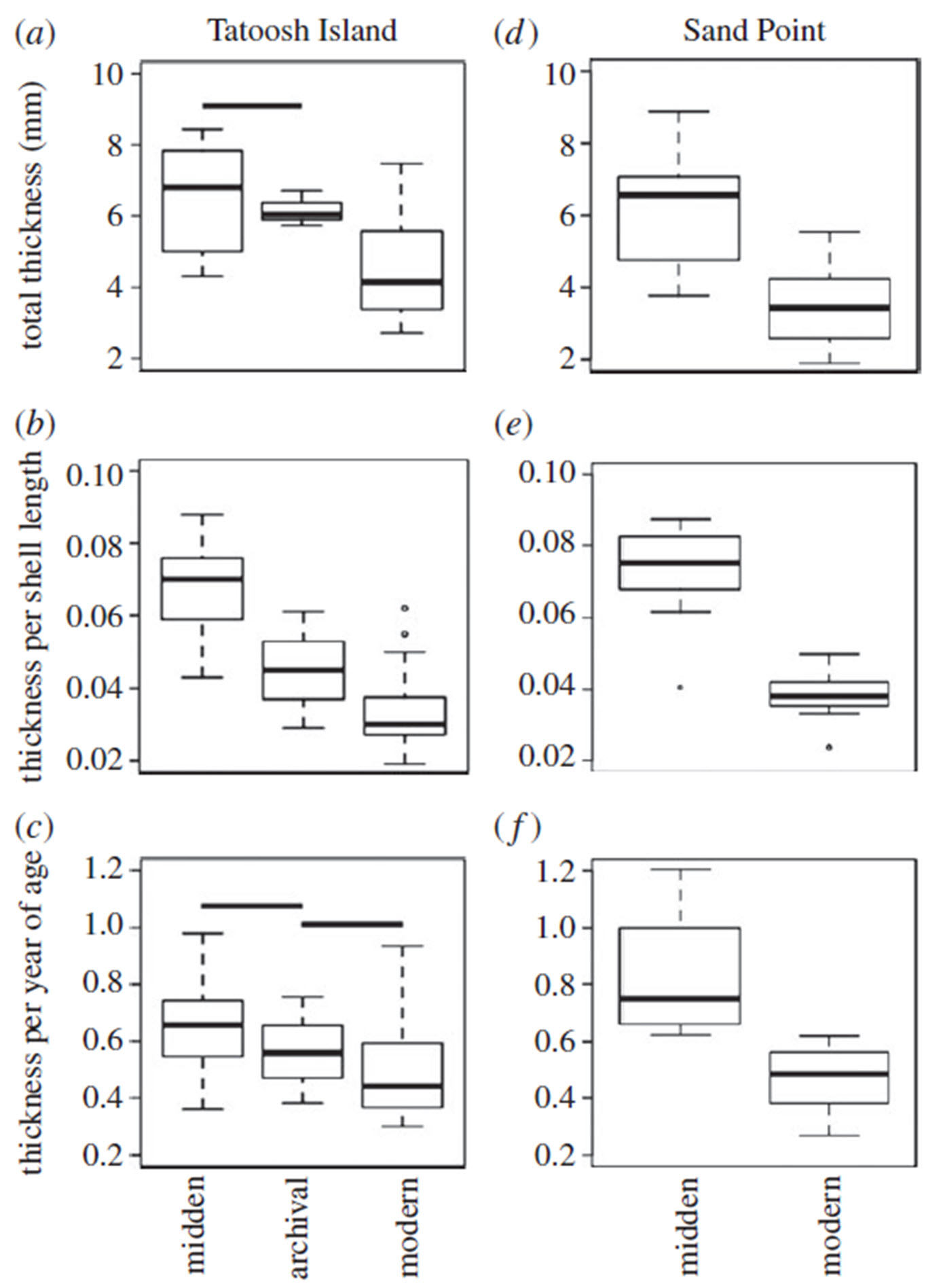
 A comparison of California mussel relative shell thickness for modern (2009–2011), archival (1970s), and midden (radiocarbon dated 1000–1340) samples at two sites in Washington state: Tatoosh Island (a–c) and Sand Point (d–f); (a, d) total thickness, (b, e) thickness per shell length, and (c, f) thickness per year of age. Image: Pfister et al., 2016.